lince

Laconi

OR · Sardegna. Seismic zone 4, 0.8% of the territory at landslide risk.

cadastral code E400 ISTAT 095082

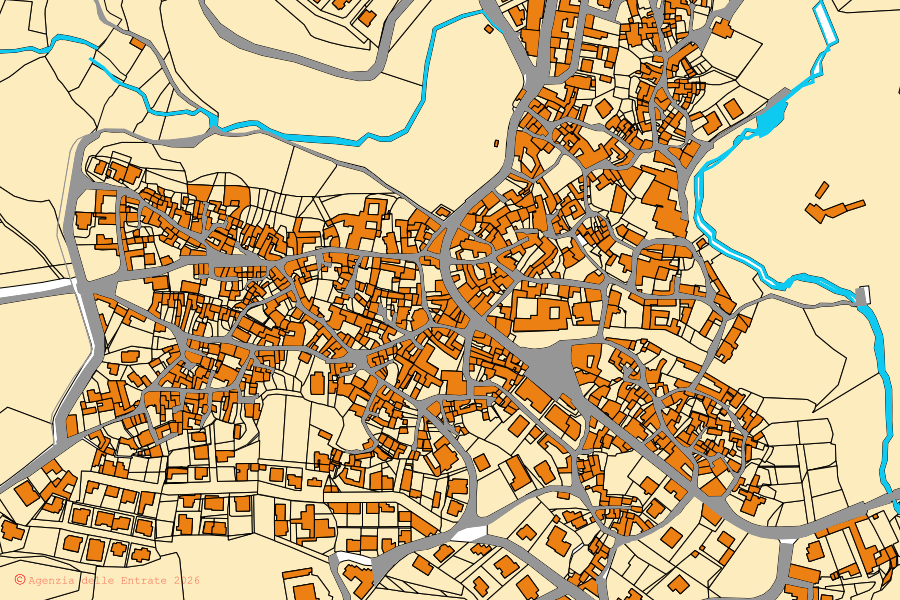
Cadastral map of Laconi

parcels © AdE
Cadastral map of the centre of Laconi: parcels and buildings, Agenzia delle Entrate cartography Open the map →

8,960 parcels · 47 sheets · 124.8 km²

Click a parcel: boundaries, risks, OMI prices.

How to find a parcel in Laconi

  1. Take the sheet (foglio) and parcel (particella) numbers from the cadastral record or the deed (if you do not have them: search by person, €4.90). E.g. «Fg. 4 part. 102»: sheet 4, parcel 102. If you only have the address, start from that.
  2. Type them in the box below, or open them on the cadastral map of Laconi, where you pick the sheet from the list of those that exist.
  3. Click the parcel for its boundary, area, OMI price ranges for the zone, seismic zone and constraints. For land where you only know the position, the boundaries can be read from the point.

The cadastral map is the official one from the Agenzia delle Entrate (Italian Revenue Agency). For a document with legal value you need the visura catastale (cadastral record, €4.90): the data on this page is for orientation.

Sheets and parcels of Laconi

GML census © AdE

Each number opens the map framed on that sheet.

Already have the sheet and parcel numbers?

Official documents for property in Laconi

No SPID (Italian digital identity) needed. Pay by card, from abroad too.

Home prices in Laconi

OMI price ranges by zone

OMI price ranges for Laconi, half-year 2025/2:

Zone B3 (centro urbano): no price for standard homes B3 Zone R1 (coltura intensiva che interessa l`intero territorio comunale prev. collinare,loc.corti noa,ducadu,perdapertuda,perdascala,su zippi): no price for standard homes R1
Click a zone to open the map there. Colour = price of standard homes. Grey: no price.
UsePrice range
Abitazioni di tipo economico€450-670/m²
Box€360-460/m²
Magazzini€485-590/m²
Negozi€810-1,000/m²

Price ranges by homogeneous zone, per square metre of gross floor area, for the ordinary market; where the municipality has several zones the table shows the overall range. Source: Agenzia delle Entrate, OMI (official price survey), half-year 2025/2.

Seismic zone of Laconi

Protezione Civile (Civil Protection) classification
zone4

Laconi is in seismic zone 4 (very low seismicity).

The lowest risk; minimal requirements.

Landslides and floods in Laconi

ISPRA · IdroGEO, national mosaic

Share of territory and residents in hazard areas. For a single parcel: the map.

Landslides P3–P4
0.8%
of the territory in areas of high or very high landslide hazard (1.0 km²)
Floods P3
0.5%
of the territory in areas that flood in the frequent scenario (0.7 km²)
Residents in landslide areas
15
people in classes P3–P4 (0.9% of the population)
Residents in flood areas
0
people in the medium scenario P2 (0.0% of the population)
Municipal area
124.8 km²
1,685 inhabitants (2021 census)

Landslides and floods on the map →

Court auctions near Laconi

within ~15 km of the centre

There are 5 court auctions open to bids within about 15 km of the centre of Laconi, in order of distance:

10 more procedures in the same area are closed or no longer open to bids (no bidders, sold, suspended).

Reserve price of a hectare of land

LandReserve priceSample
with a building on it, in the region €73,106/ha (half fall between €28,689 and €91,729) 15 procedures, 35 lots, 46 ha measured, usually at sale attempt no. 6

These are reserve prices, not prices paid: an appraiser's estimate, already reduced after sales with no bidders. Only lots where every parcel was found; a procedure counts once.

In Laconi the record counts 16 completed sale attempts between 2017 and 2026: none has yet ended in a sale.

2017: 2 sale attempts2018: 1 sale attempt2019: 2 sale attempts2020: 1 sale attempt2021: 2 sale attempts2022: 3 sale attempts2023: 1 sale attempt2024: 3 sale attempts2026: 1 sale attempt
Sale attempts per year in Laconi (hover over the bars for the numbers).

Public properties in Laconi

MEF

The state of use is declared by each body to the Ministry of Economy (census at 31 December 2023). It does not mean that a property is vacant or for sale.
Public properties on the map →

Key facts and references for Laconi

Cadastral code
E400 Agenzia delle Entrate (Italian Revenue Agency)
ISTAT code
095082 ISTAT
Province
OR
Region
Sardegna
Cadastral sheets
47 Agenzia delle Entrate, cadastral cartography
Cadastral parcels
8,960
Area
124.8 km² ISPRA
Population
1,685 ISTAT, 2021 census
Seismic zone
4 Protezione Civile (Civil Protection), seismic classification
Land at landslide risk
0.8% ISPRA, IdroGEO
Land liable to flooding
0.5% ISPRA, IdroGEO

Where these numbers come from, how often they are updated and who makes Lince: the sources.

Continue to nearby municipalities

the nearest ones with a page

Beyond Laconi

what Lince covers